Me and the California state line.
Scott walking up to an overlook at Death Valley
Scenery along the trail.
Steven and Scott
More scenery along the trail
I like all the fins on the hillsides in this picture.
At the top you can see Badwater Basin out there in the valley,
which is the lowest place in the U.S.
Scott and Steven
Scott found some shade under a bench
Salt water in Badwater Basin
This is an interesting chart of the average temperatures at Death Valley.
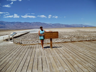
Me with the sign at Badwater Basin
The sign.
282 feet below sea level.
Scott looking at the saline water
According to the external temperature feature on our car it was 103 degrees.
The air conditioner in the car helped keep us cool
Mountains west of Death Valley as we approached the town of Lone Pine, CA
We got ice cream cones and ate them at the park in Lone Pine.
Scott has a bat finger puppet he got at the Death Valley visitor center.
Steven pounding in a tent stake with a rock.
We camped at the city park just outside Independence, CA.
Steven grins and shows his primitive tools.
Scenery from our campsite.
That's Mt. Whitney, 14,000-something feet high.
The moon over the ridge to our east.
Our new tent, mostly screen without the rainfly.
Which is why we bought it! It's nice for star-gazing.
Scott wanted to play in the water.
Independence Creek.
"But Grandma! It's COLD!"


No comments:
Post a Comment